I have been flying drones for a number of years now and it has been a hobby which has quite literally taken off. I currently hold a permission to fly commercial operations PFCO certified by the civil aviation authority. The work i am interested in is primarily air surveying using photogrammetry though i do also undertake film, photography and editing.
This essentially stitches images together to generate a 3D model. You can find more information here at http://www.airedronemappingservices.com
Lund’s Tower is a stone-built folly situated to the south-west of the North Yorkshire village of Sutton-in-Craven. It is also known as the Sutton Pinnacle, the Ethel Tower, the Jubilee Tower or, in conjunction with the nearby Wainman’s Pinnacle, the pair are referred to as the Salt and Pepper Pots.
Aire valley in the Summer 2021, absolute bliss.
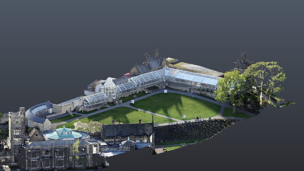
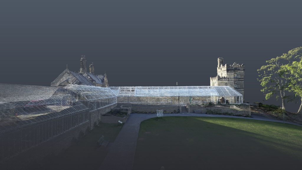
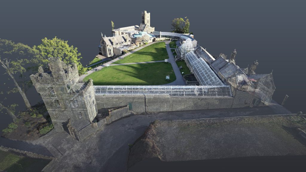
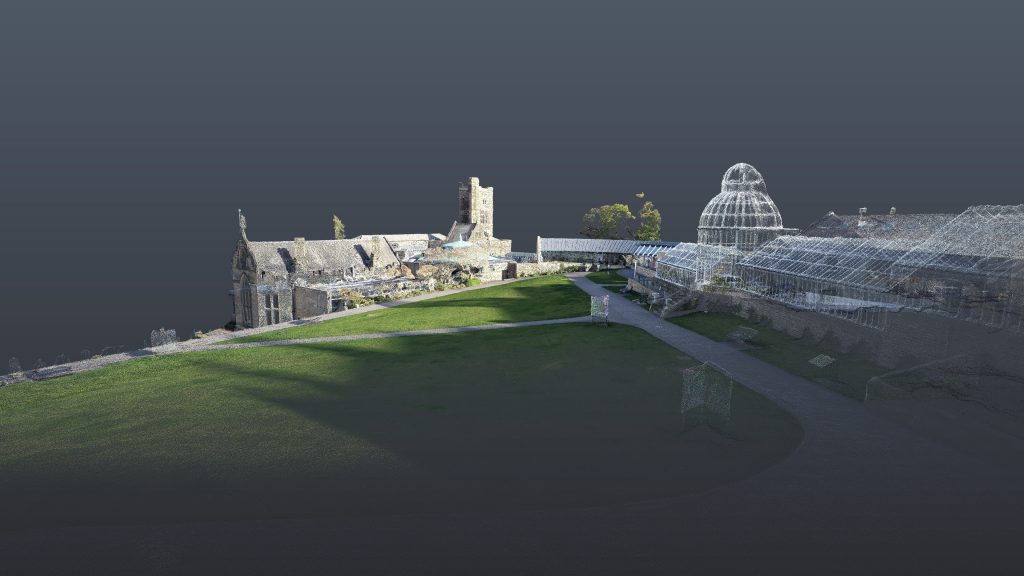
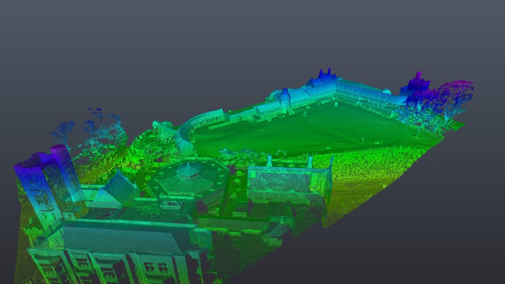
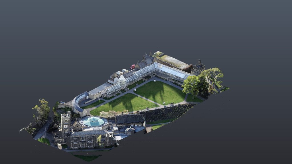
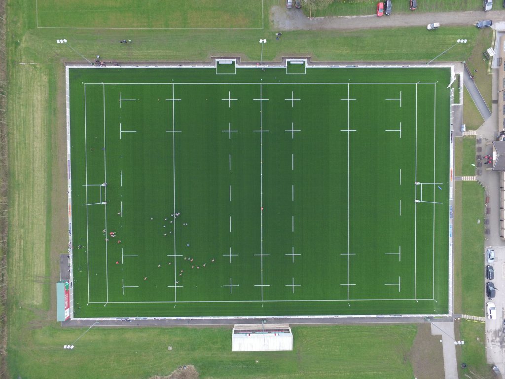
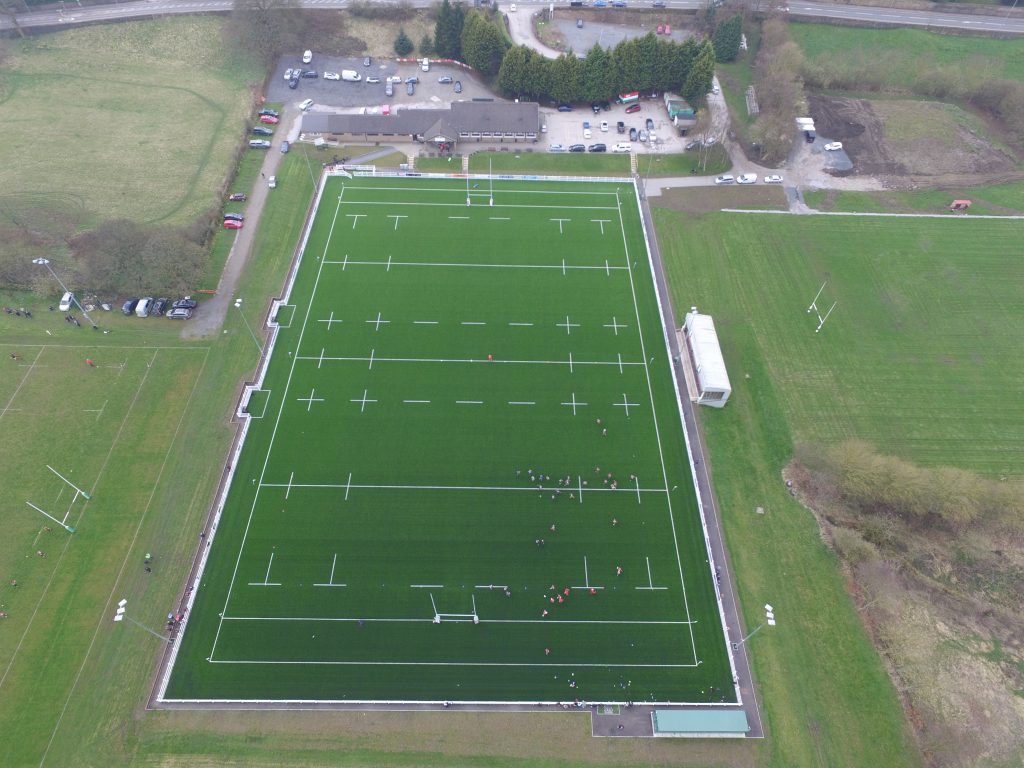
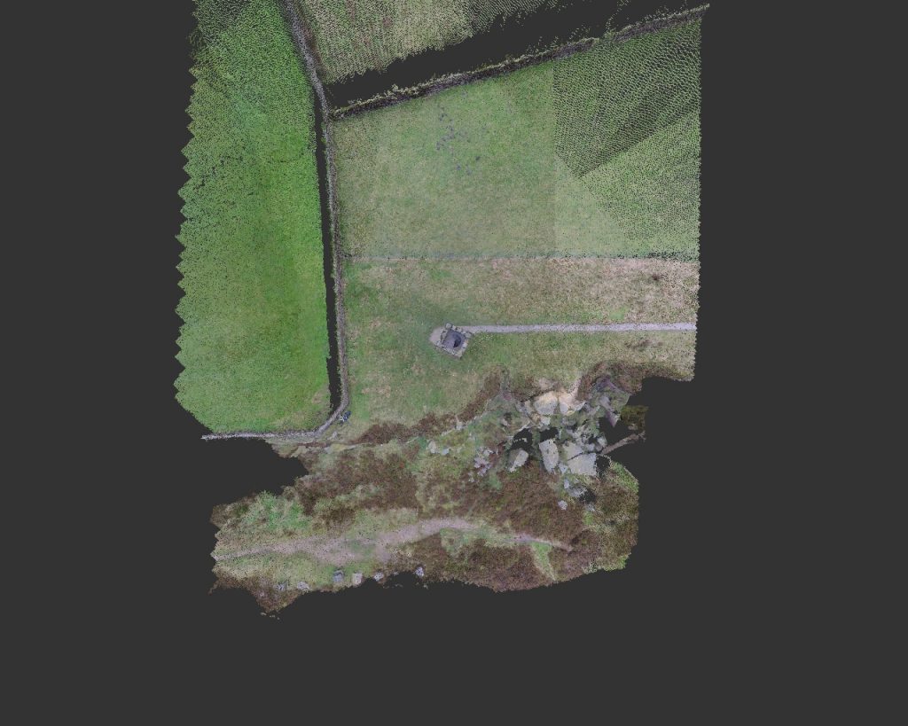
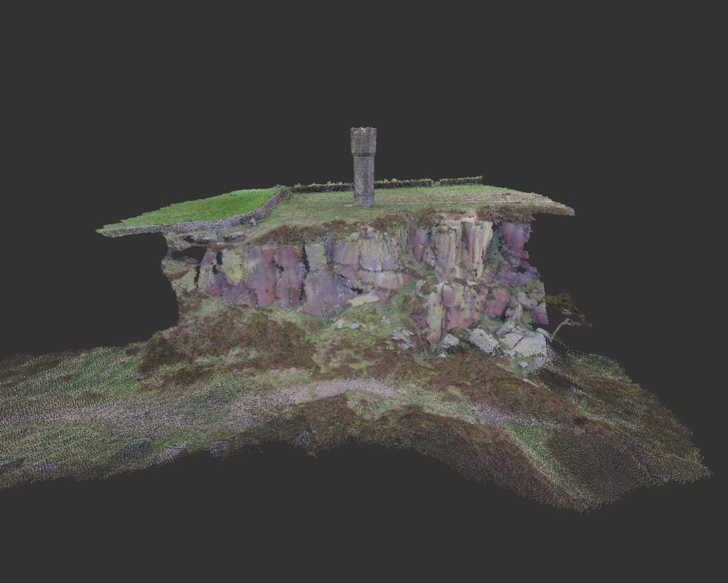
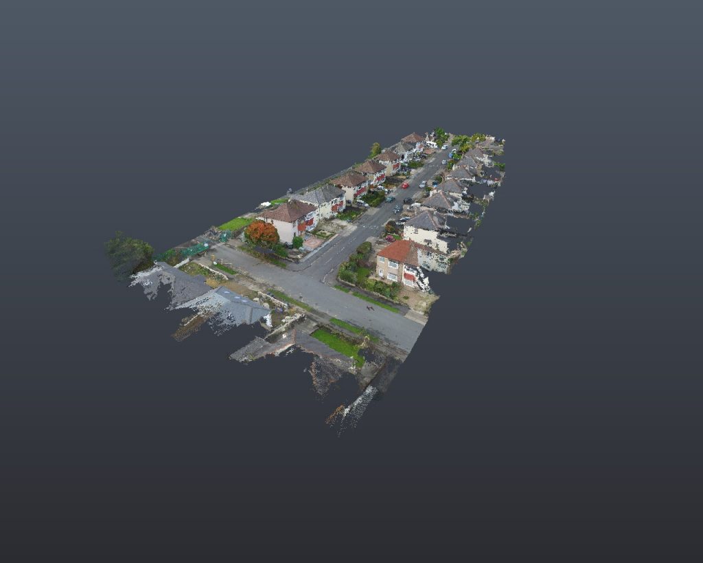
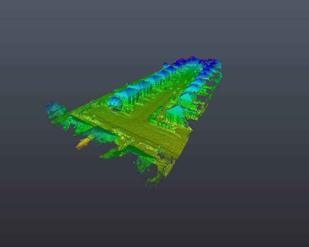
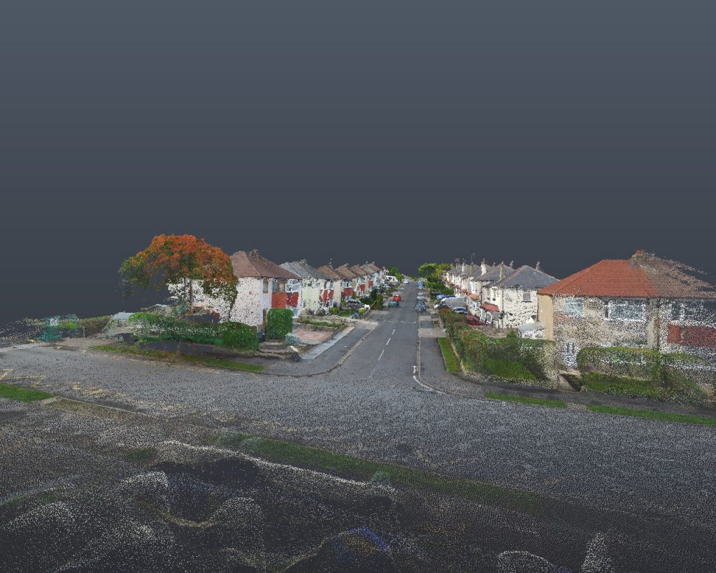
Arial Photography in HD 4k 20mp resolution, orthomosaics, accurate surveys inspections of structures and roofs, commercial and historical buildings, surveys using photogrammetry to produce 3d models and point clouds to import into your own software with contours and site levels and elevation data. As built drawings. Data can be made available in many formats. It is possible to monitor erosion, construction, site progress with cloud compare tools. Produce 3d models like Google Earth but with 10 times more detail and accuracy of built environment with accuracy up to 40mm.
Fully qualified CAA UAV pilot with a number of years of experience, insured up to 2 million public liability.